Tillamook Bay
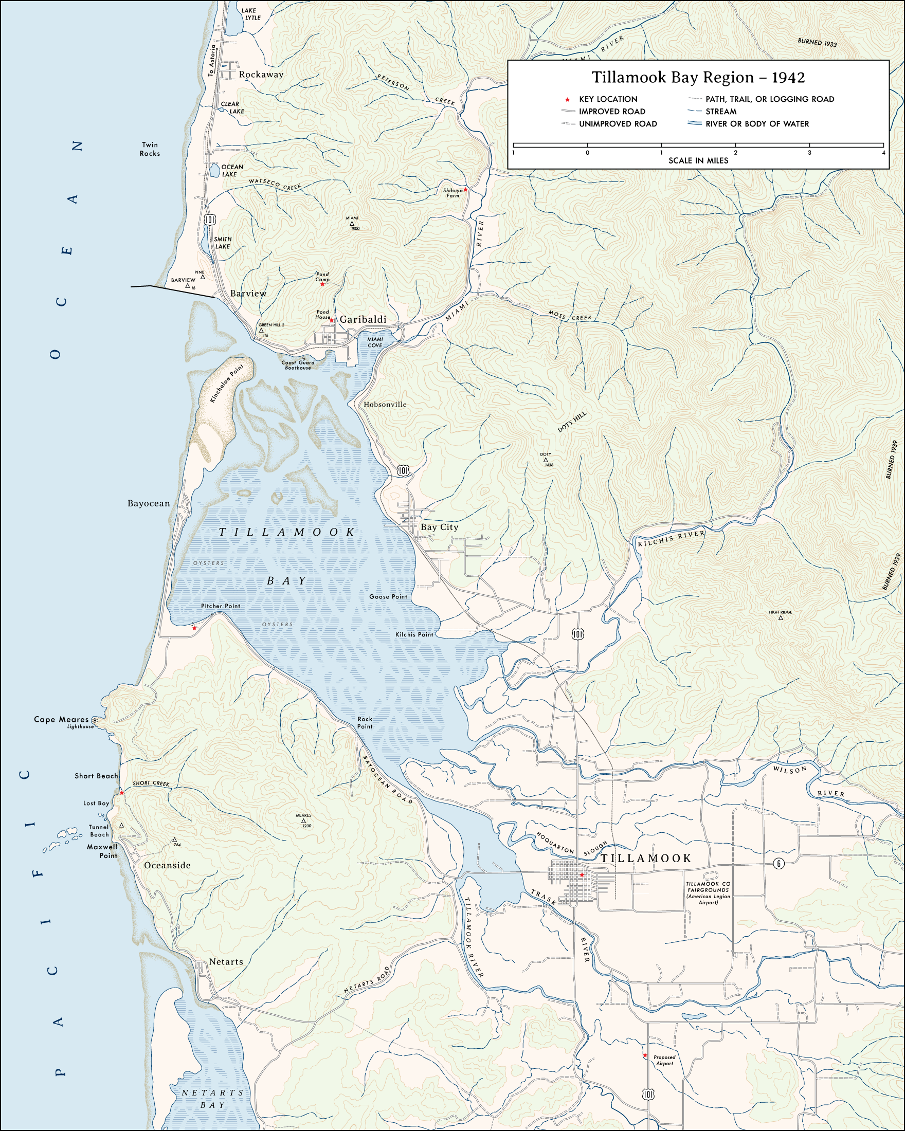
Maps of the Bay and Surrounding Areas Circa 1942These maps of the Tillamook Bay region of the Oregon Coast represent the setting for my current novel-in-progress. I offer them as a hint of what’s to come. [Notes]
Map Notes
Like the novel, these renderings are works-in-progress. While they match other maps of the period with what I hope is a fair degree of accuracy, I’ve added or modified a few elements specific to my story.
For those familiar with present day Tillamook Bay, the landscape has changed in several significant ways since 1942, and not just in terms of human development. For example, the encroaching sea threatened the once thriving resort town of Bayocean, starting not long after the completion of the north jetty in 1917 through the period this map represents. By 1942, the resort had lost a number of homes and buildings to implacable erosion. In 1960, the last house washed away. Today, the reshaped peninsula is a state park and wildlife refuge with no human habitation.
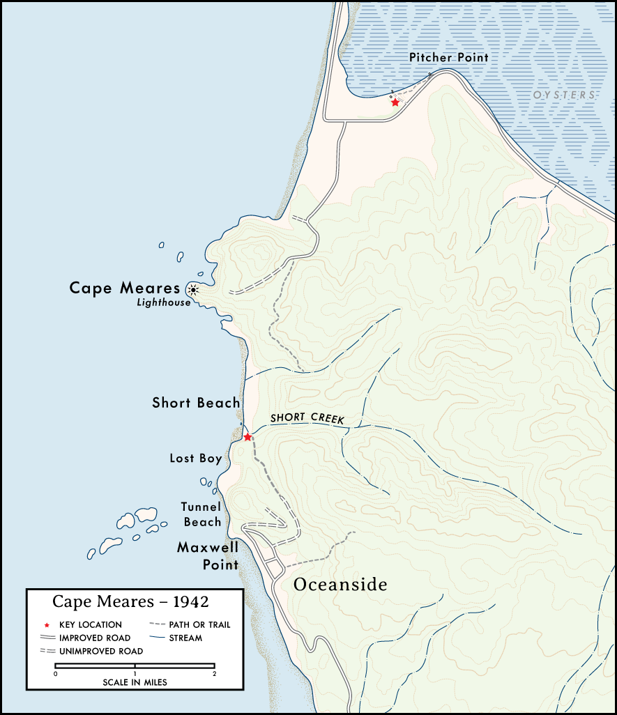
Cape Meares Detail
This closer view of the area around Cape Meares adds detail to the locations of two significant events in the novel.
Over time, even more detail may be added to an extent reasonable to avoid spoilers. I may also add an even more detailed view focusing on the area around Short Beach, though that will depend on interest—both mine and that of readers.
PDF Versions
I’ve also prepared one-color line art versions of each map. These versions will allow you to zoom in and out without a loss of (admittedly modest) detail.
Tillamook Country (PDF) | Cape Meares Detail (PDF)
Notes
I based these renderings on U.S. Army Corps of Engineers tactical maps, combining portions of the 1942 Tillamook quadrangle with portions of the 1943 Nehalem quadrangle. I also took a few details from Metsker’s Atlas of Tillamook County, 1942. Though broadly adhering to the historical sources, these maps include fictionalized modifications and additions not part of the source maps, and may also include errors I introduced unwittingly. As such, they are presented for entertainment in connection to fiction, published and unpublished, by me: Bill Cameron, or whatever name I’m writing under at the moment.

